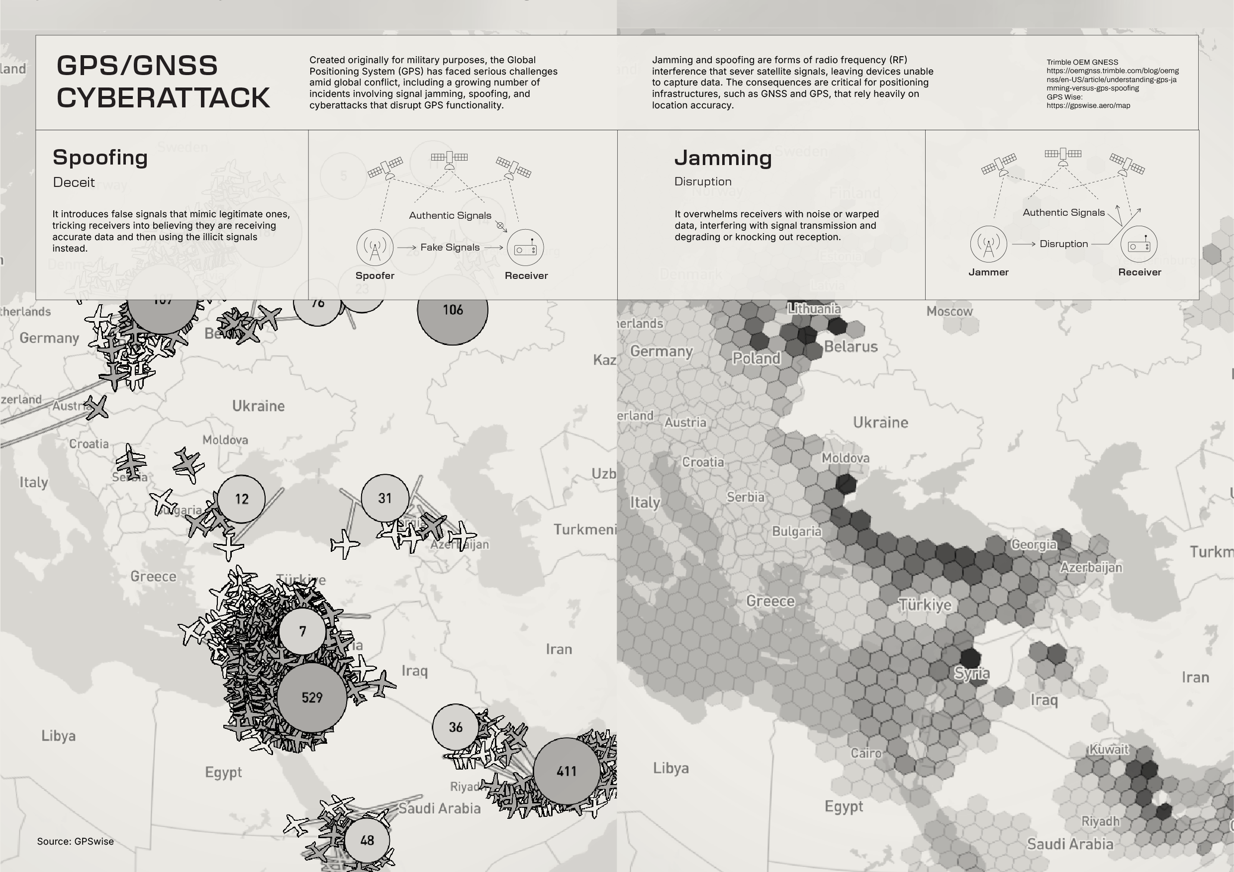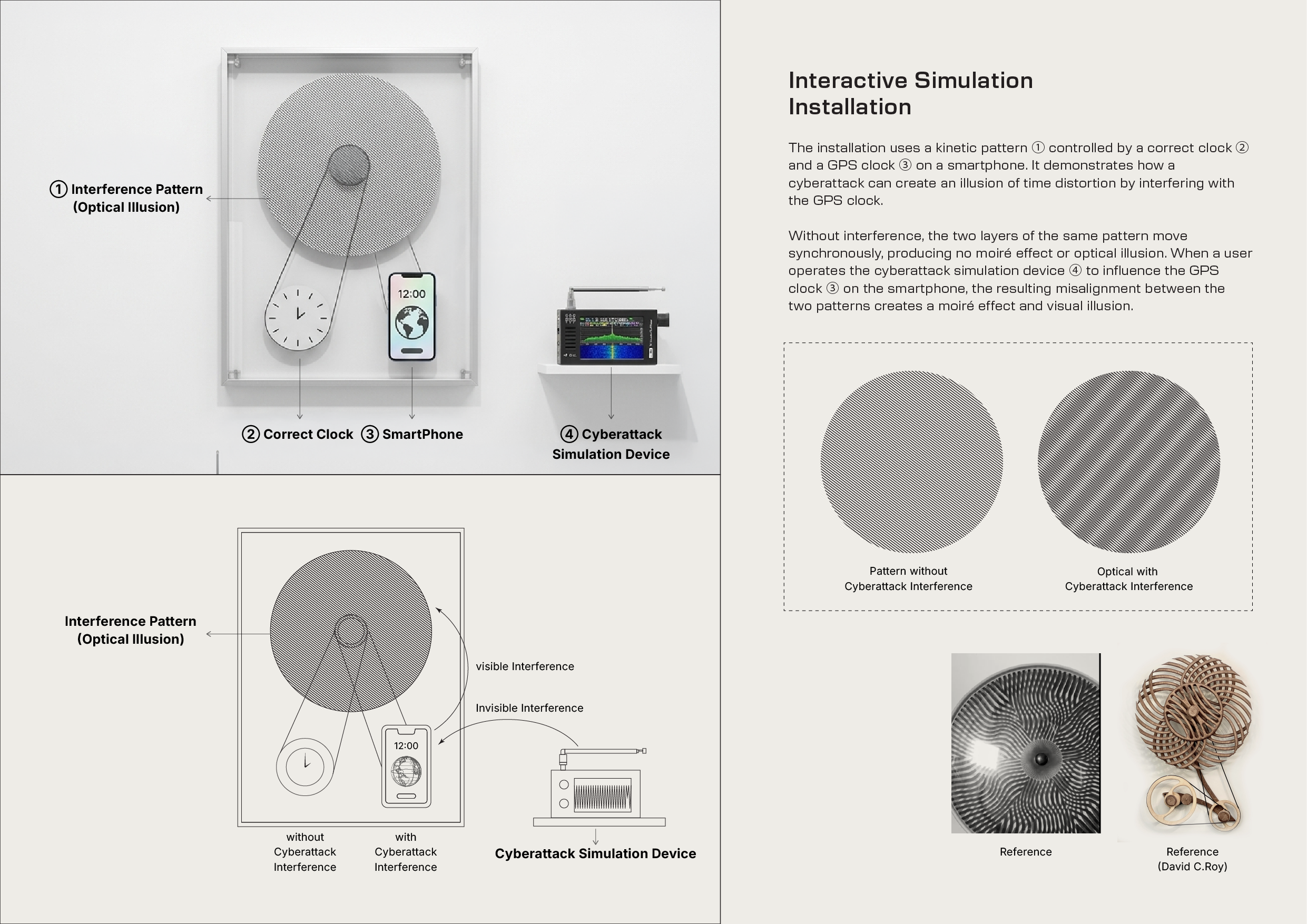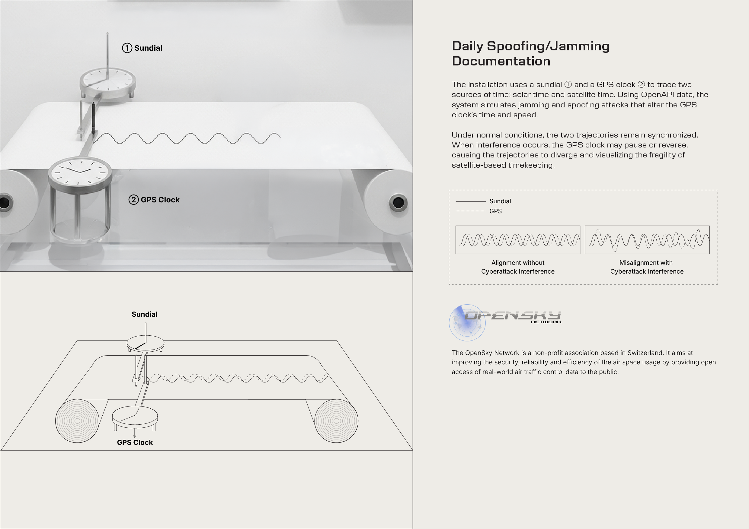
When GPS is disrupted, time and space no longer align.
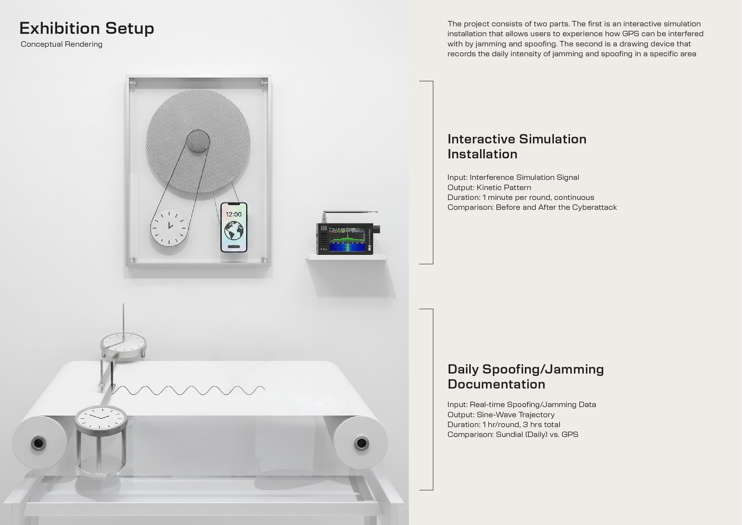
“Misalignment” is a data-visualisation installation exploring the fragility of GPS infrastructures through the lens of time and cyber interference. It questions our dependence on systems that silently define how we understand position and temporality.
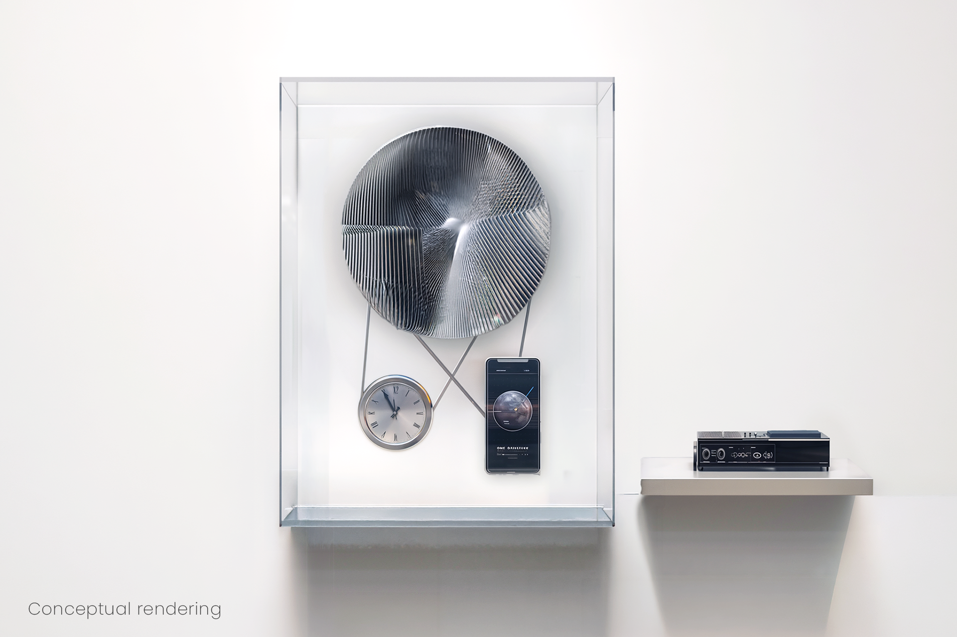
The work compares two time-keeping systems: the sundial and the GPS clock. One is grounded in physical environmental change, while the other relies on satellite signals and computational precision. Using real-time data from the OpenSky API, the system detects GPS jamming and spoofing.
A drawing machine visualises both systems as overlapping trajectories. When interference occurs, the GPS trace drifts away from the sundial-based reference, revealing distortions in both time and space.
The work reflects on how technological infrastructures can fail or be manipulated, and how “misalignment” becomes a visible condition of contemporary life.